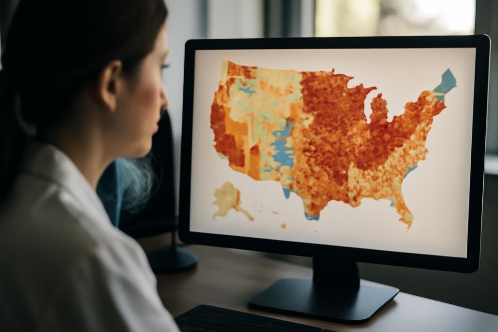
The fight against weeds is a stubborn one. They sneak into crops, steal light and nutrients, and force farmers to use herbicides or labor-intensive practices that wear down soils and budgets. Cover crops are a promising ally in this battle: they shade the ground, suppress weeds, and build soil health. But measuring how much biomass those cover crops actually produce — the daily heartbeat of their weed-suppressing power — has remained a headache. Destructive sampling along rows can tell you something, but it’s slow, costly, and hopelessly out of sync with the patchwork nature of real fields where microsites can vary from meter to meter. If you want to know where weed pressure will be strongest, you need a map that’s both fine-grained and trustworthy across an entire field.
The study I’m talking about answers that call with something both practical and futuristic: a robotic system that goes into the field, sees with its eyes and its lasers, and uses machine learning to translate those sights into a real-time estimate of cover crop biomass. This isn’t a pie-in-the-sky lab exercise. It’s a field-ready platform built at Texas A&M University with collaborators at Prairie View A&M University, led by Texas A&M’s Joe Johnson and Muthukumar Bagavathiannan. The researchers built a modular ground robot outfitted with optical cameras, depth sensors, and a LiDAR scanner to collect high-resolution, multimodal data from cover crops in a real farm setting. The aim? To produce a map of aboveground biomass at a scale that a farmer could actually act on, enabling precise weed suppression decisions and smarter planting strategies.
What makes this effort feel especially timely is how neatly it stitches three threads together: (1) a stubborn agricultural problem (weedy losses and herbicide resistance), (2) a practical, scalable sensing platform, and (3) a data-driven method that learns to read biomass from imperfect, real-world signals. The result is a clear demonstration that combining color, depth, and 3D structure can outperform single-source sensing for estimating how much biomass cover crops are producing — a proxy for how effectively they’ll choke out weeds in the months to come.
To really appreciate the achievement, picture a field that stretches far beyond a single quadrat. The researchers didn’t just haul a camera around; they mounted a modular, robot-assisted data-gathering system on a wheeled platform designed for field work. The setup included two RGB-depth cameras (the OAK-D) and a LiDAR sensor (RPLIDAR S2), all mounted on a 2-DoF Cartesian robotic platform that rides with a larger field robot called Farm-NG Amiga. The sensors capture color images, dense depth information, and precise distance measurements as the robot glides along crop rows at a steady pace. In one pass, it builds a high-fidelity impression of canopy shape, surface texture, and height — the kind of multi-layered picture you’d need to infer biomass without tearing plants out of the ground.
This is not theoretical gadgetry. The data collection occurred on a 4,000-square-meter section of an AgriLife Research farm near College Station, Texas, where cereal rye cover crops were grown at varying densities. Ground-truth biomass came from destructive sampling within small quadrats, then oven-dried to yield dry biomass figures. The comparison between these real measurements and what the robot could predict from its sensor suite anchors the study’s claims: a resilient, data-driven path toward field-scale biomass estimation that could inform targeted weed-management decisions without frying labor budgets or soil health. The hard numbers aren’t just academic; they hint at a future where a farmer can walk a field, review a biomass map, and apply herbicides where weeds would actually threaten yields — rather than spraying across the board in a best-guess gamble.
A field-ready robo-lab for sensing biomass
The hardware design sits at the heart of the project’s practicality. The researchers built a modular robot platform that can be assembled from off-the-shelf components, reducing the barrier for other labs to replicate or expand the system. A 2-DoF Cartesian frame, mounted on the Farm-NG Amiga carrier, carries two OAK-D RGB-depth cameras and a LiDAR scanner. The cameras deliver color imagery and dense depth maps, while the LiDAR adds a separate, high-resolution scan of the ground surface and canopy structure. The sensors sit about 1.5 meters above the ground, carefully positioned to optimize depth perception and minimize occlusions from leaves and stems as the robot moves along rows at roughly 0.17 meters per second (about 34 feet per minute).
The field environment is not forgiving. Crops sway in the breeze, the terrain is uneven, and the height of the canopy changes with growth stages. The team solved several of these issues with a thoughtful sensor arrangement: LiDAR mounted perpendicular to the field surface, depth cameras calibrated to yield a dense 3D picture, and a careful overlap strategy that ensures successive frames tell a coherent story when stitched together. The robot’s motion is simple, but the sensor fusion is sophisticated: a trimmed 24,570 frames of RGB and depth data were collected, providing the raw material for training machine learning models to predict biomass across the field. The researchers even used a MATLAB Simscape model to simulate the two-DoF mechanism and plan LiDAR scanning paths, helping to tune the data-collection strategy before hitting the real world again.
On the software side, the team stitched together a pipeline that fed color and depth information into several machine-learning models, from classic regressors to a purpose-built deep-learning architecture. They downsampled the images and depth maps to a common resolution to keep processing manageable, then trained models to predict dry aboveground biomass for each 0.25-square-meter quadrat. The ensemble of models included Random Forest Regression, Support Vector Regression, an artificial neural network, and a deep-learning model built on top of a ResNet-50 backbone. The lift of the study comes not from any single trick but from the fusion of modalities: RGB appearance plus depth cues plus structural information together provide richer signals about plant size, density, and architecture than any one stream alone.
In practice, this means the team wasn’t just guessing biomass from what a camera sees. They trained models to link the complex cues of a plant’s outline, texture, height, and canopy geometry to a ground-truth biomass value. The best-performing model was a deep learning system that used ResNet-50 as its backbone and fused RGB and depth features to predict biomass. This model achieved an R2 of 0.88 on dry aboveground biomass estimation — a robust result given the field’s variability. Compared with simpler models using either color or depth alone, the multimodal approach consistently improved accuracy, underscoring the value of combining signals that capture both what the plant looks like and how it is laid out in three dimensions.
From RGB to biomass reading the field’s shape
Depth maps can be fickle in outdoor settings: lighting changes, shadows, and object distance all affect how well a stereo system estimates distance. Yet, when depth information is fused with color textures and shape cues, the combined signal becomes more than the sum of its parts. In the study, the four models varied in performance, with the Random Forest and Support Vector machines offering weaker baselines and the deep-learning approach delivering the best results. The table of results shows a clear trend: the best-performing model (the ResNet-50 based system) delivered an R2 of 0.88, followed by boosted performance from integrating RGB with depth data. The RMSEs inch downward as the model grows more capable, and the relative RMSE (RRMSE) drops to around 9.9 percent for the best model — a useful gauge of predictive accuracy relative to average biomass levels.
Beyond raw numbers, the study’s nuance sits in the observation that biomass accumulation correlates with canopy height in the observed range, but the relationship is not universal across cover-crop species. The authors note that the geometry of leaves and stems matters: grasses with vertically oriented foliage can yield different predictive signals than broad-leaved or horizontally arranged canopies. That insight matters because it points to a future where biomass maps are not one-size-fits-all; they will need to adapt to the species being grown, and perhaps to the stage of growth as well. In other words, the sensing-and-learning system must understand not just how big a plant is, but what its structure says about how effectively it can suppress weeds.
The practical implications are clear: the more data and the richer the signal, the better the biomass map. The study finds a meaningful trade-off between data volume, processing speed, and predictive accuracy. Collecting more frames improves model performance but also increases computational load and time-to-insight. In real farms, where decisions often hinge on timely information, that balance matters. The authors highlight this tension honestly, noting that faster data capture can introduce sensor jitter and height fluctuations that degrade depth quality — a reminder that field-ready robotics must contend with the same messy physics as farmers do in the field.
Why this matters and where we go from here
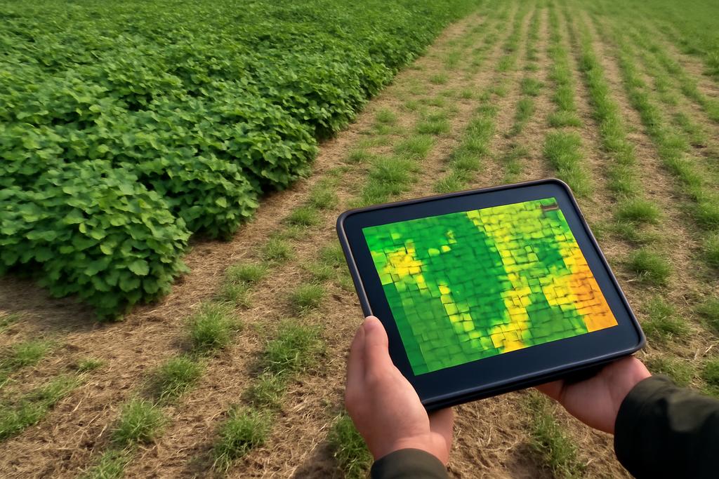
Why should a farmer or a farm adviser care about a biomass map? Because it turns a vague sense of cover-crop vigor into a precise, action-oriented plan. Biomass is a key determinant of weed suppression: high-biomass cover crops shade the soil more effectively, outcompete weeds for light, and create a physical barrier to seedling establishment. If you can quantify biomass accurately across a field, you can identify zones where weed pressure is likely to be higher and tailor management accordingly. This is precision agriculture in its most humane form: healthier soils, fewer herbicides, and more predictable harvests. The study’s results suggest that a robot-equipped sensor system, paired with robust ML models, can produce those maps at field scale, opening the door to targeted weed-control strategies and smarter cover-crop planning.
Yet the researchers are quick to temper optimism with realism. Their platform is a promising proof of concept and a practical prototype, not yet a turnkey solution for every farm. They call out the need for validation across more sites, more cover-crop species, and more growth stages. They also point to promising avenues for scaling up: integrating aerial data from drones or satellites to complement ground-based maps, and developing smartphone applications that translate biomass readings into simple, real-world decisions for farmers and extension agents. The idea of a smartphone-enabled, multimodal biomass reader is not far-fetched; it’s a natural evolution of a system designed to be modular, adaptable, and field-hardy.
The broader significance extends beyond weed suppression. The same multimodal sensing approach could, in principle, be repurposed to map other plant traits that matter for sustainable farming: biomass distribution for carbon sequestration estimates, canopy structure for irrigation planning, or injury from pests and diseases that alter plant shape in detectable ways. In an era when farms increasingly rely on data-driven management, a reliable biomass map is a valuable compass for making better, more resilient choices under variable weather, soil, and pest pressures.
As the authors note, the current work is a stepping stone toward a scalable framework for automated biomass estimation in real-world agriculture. The modular hardware design and the demonstrated value of RGB-depth fusion offer a blueprint that others can build on. In the longer arc of agricultural technology, this is the kind of incremental advance that compounds. A field robot that can read biomass, in turn guiding where and when to apply weed control, can reduce chemical inputs, save costs, and help keep soils healthier. It’s not the final word on smart weed management, but it is a meaningful, tangible move toward a future where farms are guided as much by data as by instinct—and where robots help humans do the careful, context-rich work of stewardship with less guesswork and more precision.
The study’s explicit recognition of institutional backing anchors its credibility: the work comes out of Texas A&M University, with collaboration from Prairie View A&M University, led by Joe Johnson and Muthukumar Bagavathiannan. The results mark a convincing demonstration that a robotic multimodal data acquisition platform can support deep learning models capable of predicting cover crop biomass with high fidelity in field conditions. They are not claiming a panacea, but they are offering a practical pathway to more targeted, data-driven weed management that could become a common tool in the precision-agriculture toolbox of the near future.
And that future may arrive sooner than many expect. If a farmer can pull up a biomass map on a tablet and see where biomass is robust enough to suppress weeds and where it isn’t, decisions about seeding density, cover-crop selection, and herbicide rates can shift from a blunt spectrum to a nuanced mosaic. The robot’s field data, interpreted by a resilient neural network, could become part of day-to-day farming practice — a quiet, practical revolution that treats the field as a living, measurable system rather than a patchwork of rough estimates.