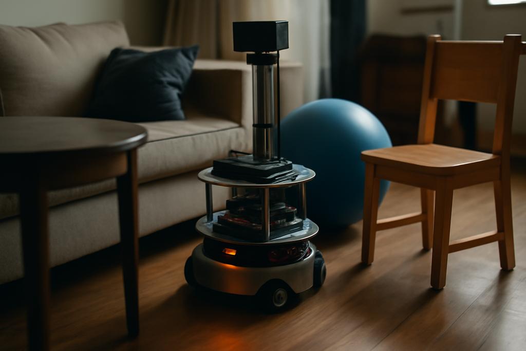
In a world where robots share crowded rooms with furniture, people, and the occasional bouncing ball of chaos, a path isn’t just a line from A to B. It’s a living corridor through space that must stay open, flexible, and forgiving. The shortest route is nice, but the real test is whether a path leaves enough breathing room for a robot to move, react, and adjust without tangling in disaster. A new study rethinks motion planning by asking not just how long a path is, but how much accessible free space it preserves along its entire length.
Researchers from The Chinese University of Hong Kong and UC San Diego, led by Jing Huang, Hao Su, and Kwok Wai Samuel Au, introduce a fresh paradigm called passage-traversing optimal path planning, or PTOPP. The central idea is to track the passages a path passes through—the narrow gaps between obstacles—and optimize a path so that, everywhere along its journey, there’s ample space to maneuver. It’s a shift from the traditional fixation on length or a single notion of clearance to a holistic sense of space along the route.
To unlock PTOPP’s potential, the team built a lightweight geometric framework that (a) detects informative passages quickly, (b) decomposes the free space into meaningful cells, and (c) formulates path costs that respect the way a path traverses those passages. The result is a planning pipeline that can plug into popular sampling-based optimizers, like PRM* and RRT*, while offering configurability that mirrors the real-world needs of robotics—whether you’re guiding a drone through a warehouse or steering a manipulator through a cluttered lab bench. The authors also show that, beyond the elegance of theory, PTOPP delivers tangible performance: comparable planning times to conventional methods, but with richer control over the space a path uses, sometimes even improving safety margins in dense environments.
All this is more than a clever trick. It speaks to a broader shift in how we think about autonomy: not just how to get somewhere, but how to stay comfortable en route. In a future where robots learn to share our spaces, planning that foregrounds accessible free space could be the key to smoother, safer, and more reliable operation.
In the paragraphs that follow, we’ll walk through what PTOPP is, how the authors detect and encode passages, and what this could mean for real-world robotics—from nimble drones to warehouse rovers and beyond. We’ll keep the math light and the pictures vivid, so you can feel why this approach might reshape how machines move through the world they share with us.
What PTOPP is and why it matters
Path planning has long wrestled with the tension between feasibility and optimality. A robot needs a collision-free route, yes, but in practice we also want the route to be robust to real-world perturbations, to leave enough room for a crowded field of objects, and to avoid being squeezed through the tiniest of gaps. Traditional metrics—path length, or even clearance (the distance to the nearest obstacle along the path)—capture a piece of the puzzle but not the whole landscape. PTOPP reframes the objective around the notion of accessible free space along the entire path, not just at a single point or the closest distance to an obstacle.
Crucially, PTOPP treats “passages” as the fundamental units of space that constrain movement. A passage is a region formed by two nearby obstacles and the way free space threads between them. If a path must squeeze through several tight channels to connect start and goal, those channels become the key determinants of how good the path really is. The core idea is to summarize a path by the list of passages it traverses, then define the path’s cost as a function of that list. In other words, a path is judged by the story of its space, not just the distance it travels.
What makes this constructive is the design of the cost functions. The authors show how to make costs monotone, bounded, and compatible with the standard guarantee frameworks that guide sampling-based planners. They boil this down to a few clean family of problem types: minimum passage width PTOPP (MPW-PTOPP), global passage width PTOPP (GPW-PTOPP), and constrained passage width PTOPP (CPW-PTOPP). Each one codifies a different philosophy about what “good space along the path” means and how aggressively to pursue it. This isn’t just academic elegance; these costs are crafted so that classic planners like PRM* and RRT* can still find optimal solutions as the sample density grows, while now being guided by the geometry of passages rather than just distance or local clearance.
In short, PTOPP throws the doors open for planners to optimize not just where robots go, but how they get there through the space that lies between obstacles. That subtle shift could ripple through any application where space is a scarce resource—think swarms of drones, multi-robot navigation in warehouses, or manipulation tasks in cluttered spaces—giving machines a more nuanced sense of “where it’s safe to pass.”
How Gabriel graphs and cells underpin PTOPP
At the heart of PTOPP is a practical trick: detect the narrow, informative passages quickly and then partition the space into manageable chunks that make checking a path’s space-traversal cheap. The authors accomplish this with a two-layered geometric pipeline built on Gabriel graphs and Delaunay triangulations. The idea is to represent obstacles not as bulky, exact shapes in a giant configuration space, but as a few crisp spatial relationships that capture where space is squeezed.
First, the paper uses the Delaunay graph of obstacle centroids to identify candidate passages, then applies what they call the Gabriel condition to prune those candidates down to the truly informative ones. The Gabriel condition says: a potential passage Pi−j between two obstacles Oi and Oj exists if the line segment connecting the closest points between those obstacles passes cleanly through free space, without being intercepted by other obstacles. This yields a sparse, interpretable graph of passages that reflect where movement could be constrained, while avoiding the explosion of possibilities you’d get if you checked every pair of obstacles in detail.
Two clever refinements make this approach robust in the wild: (1) moving from a pure point-based graph to a projection-shadow view that accounts for obstacle size, and (2) extending the notion to 3D space with height intervals. In 3D, a passage between two obstacles isn’t a flat wall; it’s a gate that can exist at certain heights. The authors define a valid height interval for a spatial passage—basically, the share of the vertical axis where free space remains through the gap. If another obstacle intrudes within that vertical window, the passage can be deemed invalid. This attention to height is essential for drones and aerial robots that fly at various altitudes through cluttered airspace.
With passages identified, the free space is partitioned into Gabriel cells: regions bounded by passages and obstacles. Each cell acts like a simple, localized room in which samples can be placed and checked for passage-traversal quickly. The upshot: when a planner proposes a path, the algorithm can rapidly tell which passages that proposed edge crosses by inspecting just a handful of nearby cells and the passages that bound them. The researchers prove that this partitioning scales gracefully with the number of obstacles and remains efficient even as spaces become more complex.
All of this preprocessing—detecting passages and forming Gabriel cells—feeds directly into the PTOPP planning loop. The path’s cost is updated as edges are considered, but crucially, only a small, local set of passages near the edge needs to be checked. This avoids the brute-force treadmill of checking every obstacle for every edge, which would erase any speed advantage. The end result is a practical, scalable pipeline that marries a geometric decomposition with the probabilistic foundations of modern planners.
What this means for robots today and tomorrow
In experiments spanning two-and three-dimensional workspaces with dozens to hundreds of obstacles, PTOPP-based planners demonstrated two big wins. First, they deliver competitive planning times with standard baselines like shortest-length planning and maximum-clearance planning. The difference isn’t just theoretical; the authors report that their methods add only modest overhead in planning time and are often on par with the fastest baselines, even as the density of obstacles grows. Second, and perhaps more important, PTOPP reshapes the shape of the optimal path. Shortest paths tend to thread the smallest possible passages, sometimes leaving little room for real-world perturbations. PTOPP plans paths that traverse wider passages, yielding routes with higher accessible free space along the entire journey. The difference is subtle on a map, but in the real world it can translate to fewer collisions, smoother operation, and greater resilience to disturbances.
Three PTOPP flavors help practitioners tune behavior to different tasks. MPW-PTOPP aims to avoid the narrowest passages along the way, thereby maintaining a robust minimum free-space width. GPW-PTOPP generalizes this idea by considering multiple narrow passages in a lexicographic order, effectively avoiding not just the single tightest bend but a sequence of potential squeezes. CPW-PTOPP adds explicit constraints: if you need to guarantee that every passage you cross is wider than a certain threshold, the planner penalizes or blocks paths that violate the rule. In practice, GPW-PTOPP often finds longer, more conservative routes that maximize space, while MPW-PTOPP can be snappier but may still offer safer trajectories in many scenarios. And CPW-PTOPP gives engineers a straightforward way to encode hard physical limits, ensuring the robot never blithely treads through a passage that would be unsafe or physically impossible for its chassis or manipulator.
But PTOPP isn’t just a theoretical curiosity. The authors show how to couple PTOPP with two of the most influential families of planners: PRM* and RRT*. In PRM*-style planning, a roadmap of samples is built and then optimized. In RRT*-style planning, a tree grows incrementally toward the goal with local rewiring to improve paths as samples accumulate. The PTOPP machinery—passages, Gabriel cells, and the cost formulations—slides into these frameworks without upending their guarantees: probabilistic completeness and asymptotic optimality remain intact because the costs are designed to be compatible with the concatenation properties that planners rely on. In other words, you don’t have to throw away decades of planner theory to adopt PTOPP; you merely layer a richer spatial objective on top of it.
Beyond the neat math and the elegant geometry, what PTOPP promises is a more human-friendly flavor of autonomy. In warehouses where robots hand off goods in a maze of aisles, or in drone fleets threading through urban canyons, the ability to intentionally maximize space along the route could reduce the cognitive load on control systems and reduce the risk of near-misses. It also offers a natural path toward more complex tasks where the environment is not static and where robots must adjust as new obstacles appear or move. The paper suggests dynamic extensions, higher-dimensional configuration spaces, and tighter integration with downstream tasks like manipulation planning as exciting directions for future work.
Smarter movement without losing simplicity
One of the most appealing aspects of PTOPP is its careful balance between sophistication and practicality. The authors do not pretend to solve motion planning once and for all; instead, they provide a modular toolkit: a way to detect where space is scarce, a way to describe and partition that space, and a flexible cost framework that makes the planner care about space in a global sense. That modularity matters in real-world robotics, where teams reuse software components, adapt plans to new hardware, and iterate quickly on task-specific requirements. PTOPP’s design makes it plausible to deploy more capable planners on robots with limited computational budgets, because the heavy lifting is front-loaded into the preprocessing and the fast, local checks that happen during planning.
For researchers and engineers, PTOPP offers a bridging language between geometry and optimization. It reframes the planning problem in terms of the space a path traverses, not just the distance a robot travels or the distance to obstacles. That shift aligns well with the intuitive needs of autonomous systems operating in clutter and complexity. The result is a story about space as a resource—a narrative in which a path is not merely a line but a space-aware journey through a field of potential squeezes and safe corridors.
And for learners, PTOPP is a vivid reminder of how clever geometry can unlock practical gains in AI and robotics. The idea of using a Gabriel graph and a Gabriel-cell decomposition to capture the skeleton of space, then weaving that skeleton into modern planners, is both elegant and accessible. It’s a reminder that sometimes the best advances come from seeing old problems—the old ones about space and proximity—from a slightly different angle and asking: what if we optimized for the space travelers move through, not just the distance they cover?
All of this is the work of a team affiliated with The Chinese University of Hong Kong and the University of California, San Diego, and it’s grounded in the real-world demands of cluttered environments. The study’s authors—Jing Huang, Hao Su, and Kwok Wai Samuel Au—bring together engineering depth and practical robotics intuition, showing that a theoretical concept can translate into algorithms that feel usable in everyday robotic tasks. It’s a reminder that progress in robotics frequently comes not from bigger shocks to the math but from smarter ways of watching and valuing the space we share with machines.
The future of robotics may well hinge on how well we design the spaces in which they operate. PTOPP is a concrete step toward that future: a framework that respects space as a resource, a method to map that resource cleanly, and a way to bake space-aware objectives into the most trusted planning engines in the field. If we want robots that move with the confidence of a seasoned driver navigating a busy city, a planning paradigm that foregrounds accessible free space could be a big part of the map that guides them there.