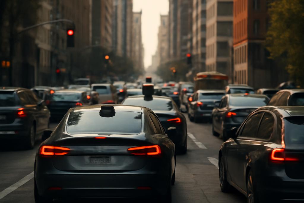
In a near future of connected streets and talking cars, a quiet math question becomes a public safety issue. If fleets of cooperative vehicles start steering the city’s traffic while human drivers watch from the sidelines, can we unravel their motives and their moves just from the total number of cars on each road? That question sits at the heart of a new line of thinking about inverse problems in transportation, a field that knows how to read patterns when the cause is murky.
Researchers Grzegorz Jamróz and Rafał Kucharski, based at the Jagiellonian University in Kraków, Poland, tackle this exact puzzle. Their work, conducted with support from a European research grant and grounded in the mathematics of network flow, asks whether the flows of a coordinated fleet can be recovered from overall traffic data, given the fleet size and the behavior pattern that guides the fleet. In other words, if you know how the total traffic behaves on every route and you know how many fleet vehicles there are, can you work backward to figure out how those fleet vehicles were distributed across the routes?
The answer is both surprising and surprisingly nuanced. The authors show that you can recover the fleet’s route flows in a robust way whenever the fleet acts more selfishly than the human drivers and the road delays respond in a well-behaved, positive way to changes in total flow. It’s a striking twist on the usual story: the more the fleet’s goals dominate the system’s behavior, the easier it is to infer its internal distribution from external observations. And if the fleet behaves in a more pro-social way, the inverse problem can become non-unique or even impossible in some networks. This isn’t just a math exercise; it hints at how cities might monitor, regulate, or even design around intelligent fleets that share the road with human drivers.
The research sits at the intersection of traffic engineering, game theory, and inverse optimization, but its punchline lands in a practical register: with the right data and the right assumptions, there is a computable fingerprint of coordinated vehicle flows in urban networks. Jamróz and Kucharski are explicit about the real-world hurdles, from discrete rounding to multiple origin-destination pairs, but they still lay down a rigorous path toward detecting and understanding collective routing in the age of autonomous mobility. The work is from the Jagiellonian University in Kraków, with the authors pointing to the broader context of autonomous and connected vehicles and the possibility that cities will need tools to understand who is “driving the bus” on any given day.
What problem the paper tackles
The setup is deliberately simple in form but rich in consequence. Imagine a city as a network of routes between an origin and a destination. On any given day, the total number of vehicles choosing each route is known, yielding a vector q that records the total flow on every route. Some fraction of those vehicles belong to a coordinated fleet, the CRV, which is guided by a centralized controller with a specific objective. The rest are human-driven vehicles, the HDVs, making their own choices. The fleet has a fixed size, qCRV, and the two groups together determine the total flow on each route.
The fleet’s day-to-day objective is written as a weighted sum of the two groups’ travel times. In plain terms, the fleet tries to minimize a cost that reflects how many HDV hours and how many CRV hours it consumes, with weights λHDV and λCRV that encode the fleet’s priorities. If the fleet is selfish, it weighs its own travel time more heavily than the HDVs’ time; if it’s altruistic, it might weight the HDVs more; or it might aim to minimize total travel time, or even act in harmful ways. The exact forward rule—how the HDVs and CRVs split traffic across routes—is described by a forward fleet assignment operator, a kind of optimizer that maps the HDV flow to the fleet’s flow given qCRV and the objective weights.
From the city’s point of view, the inverse problem asks: given q, the total flows on all routes, and the fleet’s size qCRV along with the objective weights, can we determine qCRV? Or, put differently, is the mapping from total flow to fleet flow invertible? The paper distinguishes a continuous setting, where flows can be real-valued, from a discrete setting that resembles the real world where counts are integers. In the continuous setting, the authors prove a precise condition for invertibility: if the fleet’s objective is more selfish than the human drivers (λCRV greater than λHDV) and the route delays respond in a nicely behaved way (the gradient of the travel-time function with respect to total flow is positive definite), then there exists at most one fleet flow qCRV compatible with the observed total flow q. In short: under these assumptions, you can uniquely recover how the fleet was routing itself.
There is a caveat, though, that keeps the math honest. If paths in the network are not independent—there are linear dependencies among routes—then you can get non-uniqueness. The same is true in the discrete world, where rounding and limited data can blur the inverse signal. The authors characterize these caveats with crisp counterexamples and offer a rigorous mathematical framework that clarifies when and why the inverse problem succeeds or fails.
The inverse fleet assignment theorem
The core technical achievement, called the inverse fleet assignment theorem, is more than a clever name. It formalizes a forward–inverse relationship between how a fleet chooses routes and how the total network flow looks from the outside. The route fleet assignment operator G takes the HDV flow qHDV and returns the fleet flow that minimizes the fleet’s objective, given a fixed fleet size qCRV. The total flow is then H = Id + G, meaning the observed flow is the sum of the human and fleet components on each route.
What Jamróz and Kucharski show is surprisingly direct, once you translate the math into words: if the fleet’s objective is more self-inclined than the HDV objective (λHDV < λCRV) and the travel-time landscape is well-behaved (the gradient ∇t(q) is positive definite for feasible directions), then the inverse mapping from q to qCRV is one-to-one. In other words, there is at most one way the fleet could have allocated itself across routes to produce the observed totals. This is a powerful statement because it tells us that, under plausible conditions, the city can, in principle, detect and quantify coordinated fleet routing from surface traffic counts alone.
The authors go further and spell out corollaries and extensions. If the fleet is more selfish in all rational scenarios — selfish, malicious, or disruptive behaviors all fall under this umbrella — the inverse problem is tractable. If the fleet behaves with pro-social aims, like social optimization or altruism, the map can be non-unique or even non-deterministic. They also show that the neat invertibility result extends beyond a single origin-destination pair to multiple pairs, provided a similar positive-definiteness condition holds for the (expanded) delay landscape.
Several technical subtleties anchor these conclusions. One key idea is the convexity or concavity of the fleet’s objective. When the objective is convex (as in selfish or social modes in many common delay models), the forward problem has a unique minimizer, which makes the inverse problem more likely to yield a unique fleet flow. When the objective is concave (as in certain malicious scenarios where you want to push people onto one route), the minimizers can be nonunique, which undermines the inverse; you can’t tell for sure which fleet allocation caused the observed totals. The math also addresses the forward operator’s continuity and the inverse’s continuity, tying together stability of the reconstruction with the network’s geometry and the delay functions’ forms.
What this means for cities and cars
Here the paper steps from theory toward implications. The big idea is that a city could, in principle, detect and quantify the flows of a coordinated fleet just by observing total route counts and knowing the fleet’s size and behavioral weights. That has two broad consequences. First, it offers a potential tool for traffic managers and regulators who worry that highly coordinated fleets—whether a legitimate fleet delivering services or an opaque advertising-driven route-guidance system—could destabilize traffic patterns. If you can infer how many CRVs are on which routes, you can anticipate, counteract, or regulate their impact rather than relying on indirect indicators like average travel times alone.
Second, the result sharpens a kind of privacy/competition tension in the new mobility landscape. If a city can reconstruct fleet routing from aggregate data, fleet operators have to consider the cost to themselves of being detected. On the flip side, the authors emphasize a counterintuitive point: when fleets follow pro-social or highly intelligent multi-day strategies (the Stackelberg flavor of routing, where a leader anticipates followers’ responses), the inverse problem becomes trickier and riskier to solve. Jamróz and Kucharski argue that Stackelberg-like strategies can lead to oscillatory or chaotic patterns in travel times if the fleet’s mixed strategies are deployed, making detection noisier. In other words, strategic behavior can both reveal and obscure the fleet’s footprint depending on the mathematical glass you hold up to the traffic stream.
The paper also draws a clear line between theoretical invertibility and practical applicability. In the real world you don’t observe perfect, continuous flows on routes; you observe counts that come with measurement noise, you face multiple origin-destination pairs, and you must decide what to do when there are several plausible fleet flows that could generate the same totals. The authors map these challenges candidly and outline how their theory could still guide practical detection methods, with Part II promising methods and algorithms for actually pulling CRV flows out of noisy data.
Beyond the math: real-world hurdles and ethics
One of the paper’s strengths is its humility about applying theory to messy streets. The authors discuss the leap from a continuous model to a discrete world where counts are integers and decisions happen day by day. They sketch how a city might proceed when fleet controllers round continuous allocations to integers, and how the inverse theory would behave if you only had discrete, imperfect data. They also dive into the role of multiple fleets, different classes of road users, and time-varying departures—factors that will matter as open data, simulations, and real-world trials creep closer to reality.
Ethical questions softly hover in the background. If a city can detect CRV flows from aggregate data, what are the implications for surveillance, regulation, and open competition among mobility providers? The paper frames detection as a potentially powerful governance tool but leaves explicit policy design for future work. The authors also highlight that the inverse problem is fundamentally about inference under uncertainty: even with perfect mathematics, real-world networks can defy neat inversions if routes become linearly dependent or if delays depend on flows in highly coupled, non-additive ways. That’s not a complaint; it’s a reminder that cities are living systems where theory provides a compass, not a map drawn in stone.
On the science front, the authors connect their results to a broader conversation about Stackelberg and Nash routing, two canonical game-theoretic ideas. They compare myopic routing—a simple, day-to-day greedy approach—with these more sophisticated strategies. The upshot is sobering: myopic routing, while perhaps less glamorous, may be sturdier in practice and easier to detect than sophisticated Stackelberg routing that stirs the network into unpredictable patterns. That contrast matters for policymakers who must decide which routing philosophies to encourage or regulate as autonomous fleets proliferate.
What surprised the authors and what to watch for next
One of the paper’s striking insights is the apparent asymmetry in invertibility across fleet behaviors. Selfish or malicious objectives tend to yield a cleaner, single inverse map, making the fleet’s routing more visible in total counts. Pro-social objectives, by contrast, can cloak the fleet’s moves behind a cloud of equally plausible allocations, especially in networks where routes share segments or where the delay landscape is flat in parts of the space. This dichotomy isn’t just a mathematical curiosity; it points to a practical reality: how a fleet chooses to optimize its own travel time will shape how detectable it is to city planners.
Another surprise is the robust link between a network’s geometry and the inverse problem’s fate. In networks where routes are linearly dependent, the inverse becomes fragile or outright multi-valued. The authors phrase this as a structural caveat: even with perfect data, certain network topologies resist a unique fingerprint of CRV flows. That cautions against overreliance on any single data stream and argues for richer observational strategies, perhaps combining counts, speeds, and even probe data from connected vehicles to sharpen the inverse signal.
Finally, the work hints at a broader research program that is just getting started. Extending the theory to multiple days, stochastic departure times, more general delay structures, and realistic, discrete optimization will require new algorithms and data pipelines. Jamróz and Kucharski point to their Part II as the next step, promising detection methods and algorithms designed to work in a world of imperfect information and noisy observations. The trajectory is clear: turn a deep mathematical result into practical tools that cities can use to understand and shape the evolving balance between human drivers and autonomous fleets on our streets.
Note on the authors and institution: the work is by Grzegorz Jamróz and Rafał Kucharski of the Faculty of Mathematics and Computer Science at the Jagiellonian University in Kraków, Poland. The study is framed within a European Union Horizon Europe ERC Starting Grant project, underscoring the growing interest in the social and technical implications of coordinated vehicle fleets in urban environments.
In a world where fleets might soon share our streets, the question of who routes where is not just a matter of efficiency; it’s a matter of perception, control, and governance. The inverse fleet assignment theory offers a lens to see through the fog—provided the fleet is not too good at hiding its tracks. And even when it is, the paper’s careful analysis maps out the terrain where detection remains possible, and where the math warns us to expect ambiguity. Either way, the conversation about how we design, regulate, and live with autonomous fleets has just earned a sharper compass.