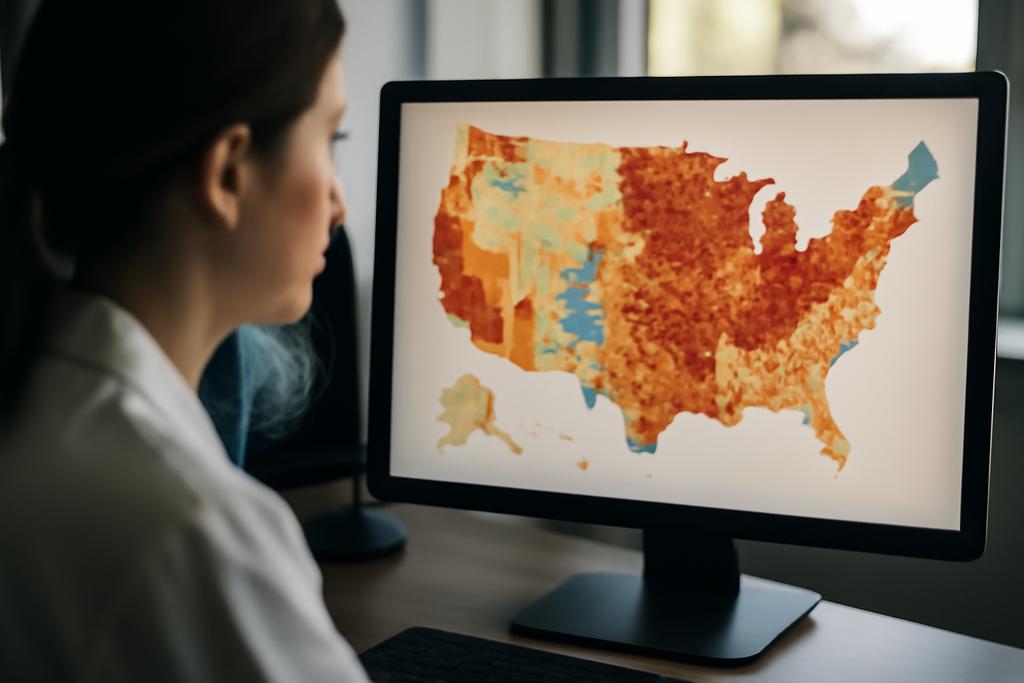
In the orbit of modern artificial intelligence, the question isn’t just whether machines can see, but how deeply they can understand a scene that unfolds at city scale. A satellite image that could swallow a small country in a single frame contains rivers, roads, buildings, parks, and a thousand little details that shift as the weather and the seasons change. The challenge for AI researchers hasn’t been just pointing a big language model at that image; it’s teaching the model to perceive, describe, count, reason about environmental conditions, and even plan routes—all from an image whose pixels stretch into the tens of thousands. The XLRS-Bench project steps into that space, proposing a rigorous, human-verified playground for multimodal large language models to demonstrate genuine perception and real-world reasoning on ultra-high-resolution remote-sensing data.
XLRS-Bench is not a casual benchmark. It is designed around image sizes that dwarf typical computer-vision test sets, with an average resolution of 8,500 by 8,500 pixels and a substantial number of images that reach 10,000 by 10,000. The authors collected 1,400 real-world ultra-high-resolution remote-sensing images, manually annotated them across 16 perception tasks and 6 reasoning tasks, and produced tens of thousands of prompts and answers in both English and Chinese. This is a test bed aimed at real-world decision-making, not just pretty captions. The work behind XLRS-Bench comes from a collaboration led by Fengxiang Wang of the National University of Defense Technology, with colleagues at Tsinghua University, Wuhan University, Beijing University of Posts and Telecommunications, and other institutions in China. The lead authorship and coordination reflect a team that understands how to translate extreme-scale imagery into human-understandable evaluations for AI systems.
Think of XLRS-Bench as a new telescope for AI perception—one that can peer across vast landscapes and still notice the small but crucial details. The benchmark pushes models to perform not only straightforward tasks like captioning or answering questions about what’s in a scene, but also more demanding cognitive feats: detecting anomalies, counting objects with spatial specificity, reasoning about environmental conditions, and planning routes within a map-like image. In other words, it asks, in effect, Can a machine not only see but also think about what it implies for people living in the real world?
What XLRS-Bench Is and Why It Matters
The core idea behind XLRS-Bench is straightforward in spirit and ambitious in scale: test multimodal large language models on ultra-high-resolution remote-sensing imagery with a structured set of tasks that cover perception and reasoning. The benchmark is built around three pillars that matter for real-world RS (remote sensing) use cases. First, image size matters: real ultra-high-resolution RS images capture entire urban skylines or sprawling landscapes, with objects that can be minuscule in the frame yet vitally important for analysis. XLRS-Bench’s average size of 8,500 × 8,500 pixels, and its 840 images at 10,000 × 10,000 resolution, push models to work with data at scales they will encounter in practice. Second, data quality and task diversity matter: every annotation is human-verified, and the suite includes 16 perception tasks and 6 reasoning tasks, ranging from counting and land-use classification to complex spatiotemporal reasoning and route planning. Third, linguistic breadth matters: XLRS-Bench includes bilingual annotations in English and Chinese, allowing researchers to study how multilingual LLMs handle RS content and descriptions across languages.
From a human perspective, XLRS-Bench is a lens on what AI still struggles with when the stakes are high. The tasks are designed not for games of syntax or trivia, but for decisions that could influence urban planning, disaster assessment, environmental monitoring, and resource management. The benchmark’s design acknowledges a core reality of RS data: the more you zoom in, the more you reveal—and the more the model must infer about context, change, and causality. In that sense, XLRS-Bench isn’t just about “seeing” more; it’s about reasoning with more information, at higher fidelity, over longer sequences of space and time.
The study’s framing makes a bold claim: while broad, image-agnostic multimodal models perform well on generic vision-language tasks, they falter when confronted with ultra-high-resolution RS scenes that demand long-range spatial reasoning and nuanced interpretation of dynamic changes. That gap isn’t just a translation error or a failure of vocabulary. It’s a mismatch between the training regime of many MLLMs and the specific, high-stakes demands of remote sensing. The XLRS-Bench authors argue, persuasively, that the path toward reliable RS AI will require dedicated benchmarks to guide the development of models that can perceive at scale and reason under real-world constraints.
In a field where big data increasingly translates into big decisions, XLRS-Bench is a compass. It tells researchers where current models excel, where they stall, and where new approaches are needed. It also actively addresses a practical problem researchers have wrestled with: how to generate high-quality, large-scale annotations without burning through the hours of expert labor normally required. The team uses a semi-automatic captioning pipeline that leverages GPT-4o for pre-annotation, followed by meticulous human verification, and cross-checks by domain specialists. This hybrid workflow reflects a pragmatic path forward for building trustworthy datasets in specialized domains.
As a methodological leap, the xlRS-Bench suite is built to stress the cognitive aspects of perception (capturing details in an image, counting, identifying relationships) and the reasoning aspects (anomaly detection, environmental reasoning, route planning, and spatiotemporal reasoning). The authors explicitly recognize that current general-purpose MLLMs struggle with ultra-high-resolution tasks that demand precise localization, long-range context, and careful change detection. The implications go beyond the RS community: if we want AI that can help manage cities from space, we need benchmarks that mirror the complexity of real-world scenes and the cognitive steps needed to act on them.
How XLRS-Bench Probes the Minds of Multimodal LLMs
XLRS-Bench isn’t just a data dump; it’s a carefully curated experimental platform. It includes 16 sub-tasks that span two broad capability families: perception and reasoning. Perception tasks involve recognizing, counting, and grounding objects in the image, while reasoning tasks push models to infer conditions, plan routes, detect anomalies, and understand how things change over time. The tasks aren’t shallow multiple-choice questions; many require precise localization (down to a few pixels), counting across large scenes, or comparing two time-separated RS images to detect changes.
To test models on these tasks, the researchers gathered 1,400 real-world ultra-high-resolution RS images from existing detection and segmentation datasets. The annotation process was rigorous: 45 experts plus a cross-validation regime, three independent annotation groups, and an external review team ensured that the data were accurate and unbiased. The surface layer of the dataset includes 32,389 VQA pairs, 12,619 visual grounding instances, and 934 detailed captions—altogether a substantial corpus that makes XLRS-Bench a credible test bed for RS-focused LLMs.
One of the most striking aspects of the XLRS-Bench results is the gap between what the best models can do on conventional benchmarks and what they can do on ultra-high-resolution RS data. In VQA tasks across 16 perceptual and reasoning dimensions, most models scored well below 50% on many fine-grained tasks, with performance in the 30–40% range for several challenging sub-tasks. Even the best open-source models, which often exploit high-resolution input or sophisticated multimodal alignment, struggle with tasks like fine-grained visual grounding or spatiotemporal reasoning that involve nuanced context and precise localization. The paper notes an especially large gap between anomaly reasoning and spatiotemporal reasoning: models handle the former reasonably well but falter when asked to infer how things change over time in space. That isn’t a minor gap; it’s a window into the kind of temporal cognition RS AI needs to become truly robust.
Another telling result concerns input resolution. Models that can ingest higher-resolution inputs tend to perform better on perception-heavy tasks, underscoring a practical truth: if you squeeze a 10,000 × 10,000 image into a 4K patch, you’re likely to lose critical local information. Even so, there’s a catch: many of the leading models are not yet designed to optimally process such enormous inputs in a single pass. The authors argue for specialized RS-focused architectures and training regimes that preserve local detail without collapsing global structure. That may require new neural-network primitives, better patching strategies, or different forms of cross-modal fusion that can respect the scale at which objects live in these images.
XLRS-Bench also reveals something about language models themselves. In long, descriptive captions that attempt to capture both macro structure and micro details, some models—especially larger, more expensive systems—can generate impressively long, coherent text. But when asked to ground that text in precise visual cues, or to point to specific objects in a 10,000×10,000 image, the models stumble. That dichotomy—linguistic fluency without robust visual grounding—speaks to a broader truth about multimodal AI: capability is not uniform across modalities, and bridging the gap between language and perception remains a central challenge, especially at scale.
To ensure that results aren’t biased by fancy prompting or data artifacts, the XLRS-Bench team employed a zero-shot evaluation setup with uniform prompts and used a rigorous evaluation protocol. For grounding tasks, they used IoU-based accuracy thresholds to assess whether predicted bounding boxes align with ground-truth regions. For captioning, they measured standard metrics like BLEU, METEOR, and ROUGE-L, but they also emphasized human validation to check for alignment with the image content. The combination of automated metrics and human oversight helps guard against overinterpretation of model prowess in a domain where the stakes of error are real—think misidentified infrastructure or misread environmental change with consequences for planning and policy.
The study also highlights the practical reality that we should not rely on a handful of giant models as universal solutions. The results show mixed performance across categories: some models excel in English but not Chinese, or vice versa, and some perform better on perception than on high-level reasoning tasks. This heterogeneity is a reminder that building reliable RS AI will require not just bigger models, but smarter training data, better task alignment, and perhaps domain-specific architectures tuned to the quirks of satellite imagery.
What This Benchmark Teaches Us About the Real World
Beyond the numbers, XLRS-Bench is a map of how AI could influence how we live with and manage our environment. Consider urban planning and disaster response. Ultra-high-resolution RS data can reveal how densely people live in a city, where open spaces are located, and how infrastructure performs under stress. But to translate that into decisions, a model must do more than spit out a pretty caption; it must reason about causality, changes over time, and plausible interventions. That is precisely what the benchmark is designed to probe: can an AI model propose changes that improve resilience, or reason about the environmental costs and benefits of a proposed development?
XLRS-Bench underscores a practical truth: in remote sensing, resolution is not only about detail; it matters for change detection and long-horizon planning. The paper notes that current models struggle with spatiotemporal reasoning and change detection across time-lapsed RS imagery. If you’re monitoring a coastline, a floodplain, or an urban expansion front, being able to detect subtle shifts and forecast potential outcomes is as important as recognizing a building or a road. This is where domain-specific training, richer multi-temporal data, and stronger cross-modal grounding become essential. The authors argue for a roadmap of research that couples ultra-high-resolution perception with robust, context-aware reasoning—an AI that can not only describe a map but also reason about what the map implies for communities and ecosystems over time.
From a policy and ethics vantage point, XLRS-Bench invites a careful discussion about governance and accountability. As we rely more on AI for interpreting satellite data, questions of bias, privacy, and error modes become urgent. The authors acknowledge safety and societal impact concerns: overreliance on a benchmark, or on automated systems, could lead to risky decision-making if humans do not retain oversight. This is not a techno-optimist manifesto; it’s a call for responsible AI that augments experts rather than replaces them, with explicit attention to calibration, validation, and human-in-the-loop decision-making. The dataset’s bilingual dimension adds another layer of inclusivity and fairness, ensuring that models can be evaluated across languages and thus across diverse user communities who rely on RS data for different purposes.
In a field crowded with impressive claims about “solving VQA” or “captioning with flair,” XLRS-Bench is a sober reminder that the hardest problems lie at the intersection of scale, precision, and real-world impact. The paper’s authors argue for specialized, purpose-built models that can simultaneously handle the global structure of a landscape and the micro-geometry of individual objects. It’s a tall order, but one that maps more cleanly to actual needs—monitoring deforestation, tracing urban sprawl, coordinating disaster relief, guiding agricultural decisions—than most benchmark-driven hype.
The broader lesson is about a future where AI’s perception and reasoning illuminate the Earth with greater fidelity and responsibility. The XLRS-Bench effort sets a baseline for the kinds of capabilities we’ll need in the years ahead: more reliable visual grounding at scale, robust spatiotemporal reasoning, and the ability to translate dense visual data into actionable insight for planners, researchers, and communities. If the models eventually reach a level where they can reliably count, locate, and reason about changes across thousands of square kilometers, the implications for environmental stewardship and urban resilience could be transformative.
For researchers and curious readers, the takeaway is both technical and philosophical. On the technical front, XLRS-Bench is a blueprint for how to design evaluation suites that reflect the realities of ultra-high-resolution RS data. On the philosophical front, it challenges us to imagine AI that doesn’t just describe space, but reason about it—how it evolves, who it serves, and how to act on what it reveals. The path there isn’t a single leap; it’s a tapestry of better data, smarter models, and careful, human-centered deployment.
As the field progresses, the XLRS-Bench team plans to release their dataset openly, inviting researchers to contribute, improve, and benchmark new models on ever more challenging RS scenarios. The collaboration across leading Chinese universities and research centers signals a growing, global commitment to pushing AI beyond glossy demonstrations toward practical, responsible tools for understanding our planet from above. If you’re curious about the future of AI-enabled Earth observation, XLRS-Bench offers a compelling glimpse into the kind of cognitive work—perception plus reasoning—that will define it.
In short: XLRS-Bench is a rigorous test bed for whether multimodal AI can truly understand ultra-high-resolution remote sensing, not just describe it. It’s a reminder that the next frontier of AI isn’t merely bigger models; it’s smarter models that can see with the level of detail real-world decisions demand, reason across space and time, and help humans act more wisely about the landscapes we inhabit.
Lead researchers and institutions: The XLRS-Bench project was led by Fengxiang Wang at the National University of Defense Technology, with significant contributions from researchers at Tsinghua University, Wuhan University, Beijing University of Posts and Telecommunications, and other Chinese institutions. The work represents a collaborative effort to establish a high-fidelity, multilingual, multi-task benchmark for remote-sensing vision-language models, and to chart a path toward AI that can reason about the Earth at ultra-high resolution.